|
Location
Qurgashin qala is known as Kurgashin Kala in Russian. We use the Latin transliteration of the Qaraqalpaq spelling.
Qurgashin qala from the west.
Qurgashin qala lies about 24km due east of Ayaz qala. From Ayaz qala Yurt Camp return on the rough track that runs south from Ayaz qala 2 until you
reach the metalled road. Continue south for a further 1.4km, crossing the canal and taking the first left. Drive east for 6.3km and turn left at
the t-junction. After a further 2km this new road bends sharply to the right - the ruins of Little Qırq Qız qala can be seen to the
north of the road on the left.
From this bend the road now continues in a straight easterly direction all the way to Qurgashin qala. Some 4.5km from the bend you first pass close to
Big Qırq Qız qala on the left, and after 8.2km you cross a bridge over the canal. Finally after 18.5km from the bend you reach Qurgashin
qala, which is situated in a prominent elevated position on the right of the road.
Qurgashin qala
Qurgashin qala was one of the frontier fortresses defending the northern flank of Khorezm from nomadic attack. It was built around the end of the
4th or possibly in the early 3rd century BC. It may have been garrisoned by professional troops.
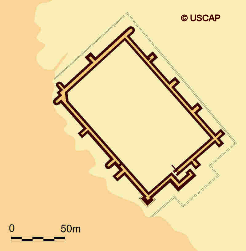
Plan of Qurgashin qala.
Image courtesy of Associate Professor Alison Betts, University of Sydney Central Asian Programme.
A preliminary investigation of Qurgashin qala was undertaken by Sergey Tolstov and some of his colleagues from the Khorezm Archaeological Expedition
in 1939. More detailed excavations were undertaken by Kolyakov in 1986 and 1991 and the military architecture was studied by Xojaniyazov in the
1980s.
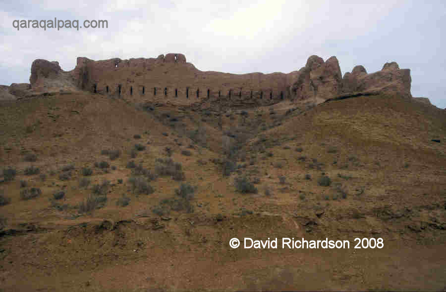
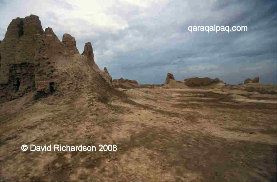
The fort is dramatically situated on the edge of a slightly elevated plateau so that when seen from the west it appears to be raised up above the level
of the desert plain. It is this south-western flank that is in the best preserved condition.
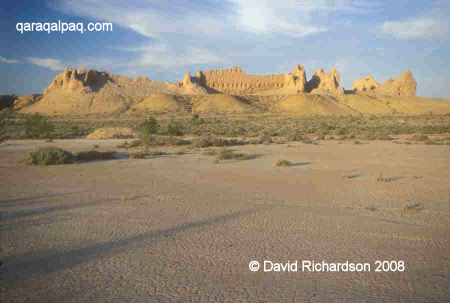
The fort of Qurgashin qala looks more imposing from the foot of the escarpment.
View from the south-west.
The citadel is rectangular, measuring about 130 metres long and 90 metres wide, and it is oriented so that its corners face the four cardinal directions.
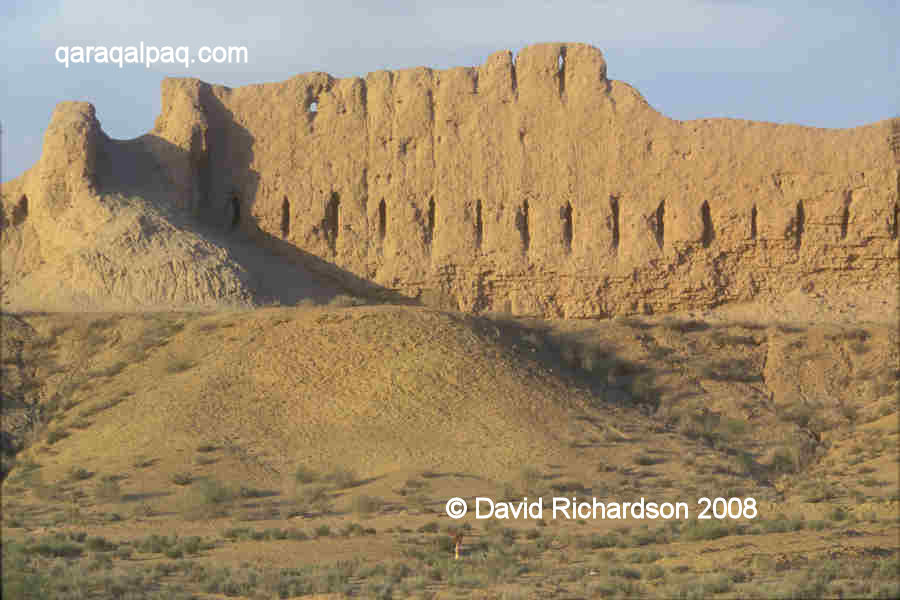
There is an outer and an inner perimeter wall, separated by a space of roughly two metres for the provision of archers' galleries. The unfired mud-
brick walls are built on a paqsa base and are slightly inclined inwards. In some places today they reach as high as 14 to 16 metres.
The best preserved section of the outer curtain wall at Qurgashin qala.
Note the two tiers of loopholes.
View from one of the arrow-shaped loopholes at Qurgashin qala.
The fort has a rather irregular design – every corner is reinforced with a different arrangement of tower, either rectangular or semi-oval and either
single or in pairs. The external curtain walls and towers contain two tiers of arrow-shaped loopholes.
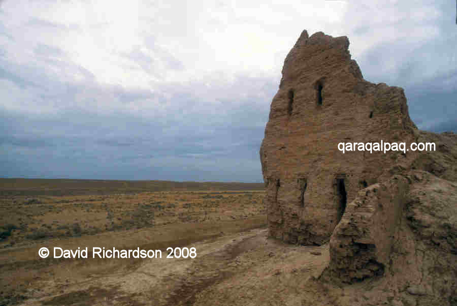
Remains of one of the rectangular towers at Qurgashin qala.
The single entrance is positioned in the centre of the south-east wall and is defended by a rectangular barbican.
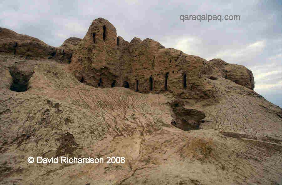
Badly eroded section around the entrance to Qurgashin qala.
The fortress was surrounded on three sides by a low outer defensive barrier or wall, known as a proteichisma, built of mud-brick about 10
metres out from the curtain walls. This did not extend around the south-western flank of the fort since this was protected by the natural escarpment
of the site. The proteichisma made it difficult for attackers to get close or to manoeuvre siege engines up to the fortress wall.
The interior of Qurgashin qala.
Unlike Ayaz qala 1, Qurgashin qala was not an open refuge but was completely occupied with residential buildings. It sat in the centre of a large
agricultural area, watered by a large canal with many side channels. The oasis was occupied by many small settlements surrounding the central
qala. Today the whole area surrounding the site is covered with fragments of pottery.
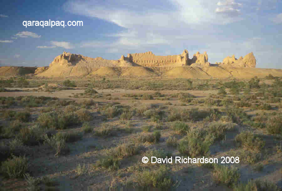
Qurgashin qala just before sunset.
A second stage of construction seems to have taken place at the site around the 1st to the 3rd centuries AD, when the barbican was modified and an
entrance ramp was added. The fortress continued to be occupied up until the end of the 3rd to 4th centuries AD, after which it was abandoned, as was
the surrounding agricultural oasis. We assume that the cause was a natural drying-up of the local water supply
Google Earth Coordinates
Unfortunately this region of Qaraqalpaqstan is not well covered on Google Earth. The following reference point (in degrees and digital minutes)
will enable you to only roughly locate Qurgashin qala.
| | Google Earth Coordinates |
|---|
| Place | Latitude North | Longitude East |
|---|
| Qurgashin qala | 42º 2.040 | 61º 19.340 |
| | | |
Note that these are not GPS measurements taken on the ground.
Return to top of page
Home Page
|