|
Location
Big Gu'ldu'rsin qala (or Bol'shoi Guldursun Kala in its Russian form) lies just over 15km due north of To'rtku'l in the Ellikqala tuman of
Qaraqalpaqstan. The citadel is located within a small rural community and is surrounded by houses and cultivated fields. It lies to the west of the
Tazabagyab irrigation canal.
Big Gu'ldu'rsin qala.
To reach Gu'ldu'rsin qala from To'rtku'l drive west from the city centre on the main road heading for Biruniy. 2km from the city centre, turn right at
the crossroads heading north past the main sports stadium. Some 11.5km from the crossroad the road enters a long right hand bend, crosses a canal, then
bends back to the left. Continue until you are 16km from the To'rtk'ol crossroads and then take a left hand side road. After a further ½km you
will see the ruins of Gu'ldu'rsin on your right.
Excavations
The medieval remains of Big Gu'ldu'rsin qala were investigated by Yakh'ya Gulyamov in 1937. The site was re-examined by Xojaniyazov and Manilov in
the early 1980s.
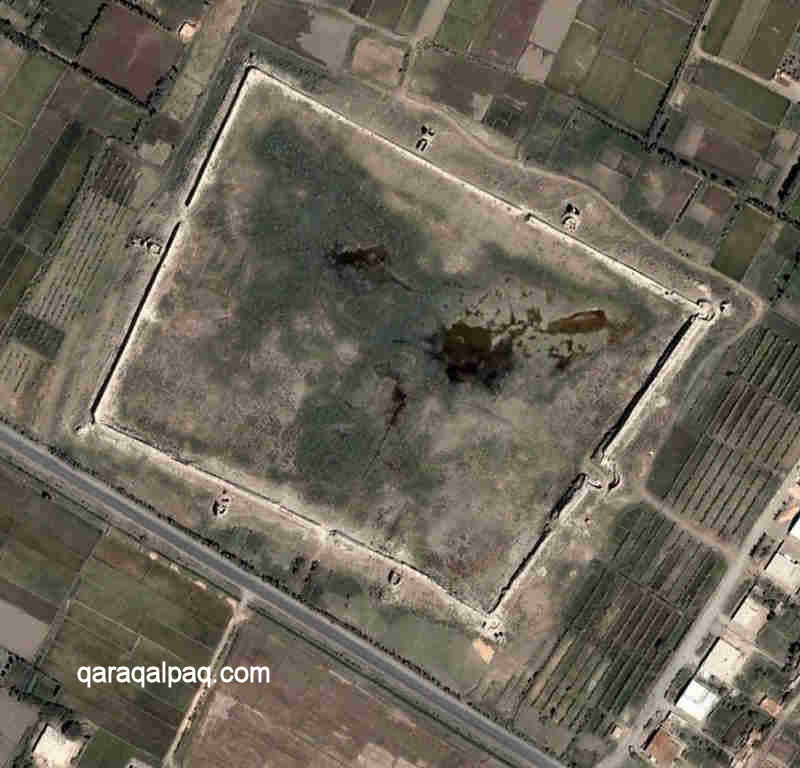
Satellite image of Big Gu'ldu'rsin qala. Image courtesy of Google Earth.
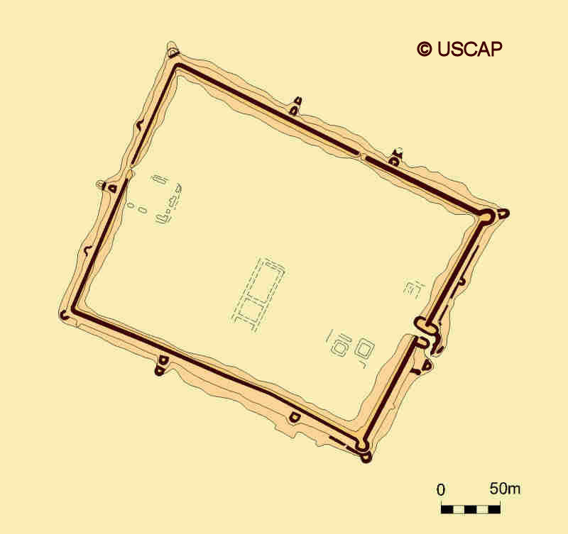
Schematic plan of Big Gu'ldu'rsin qala.
Image courtesy of Associate Professor Alison Betts, University of Sydney Central Asian Programme.
Big Gu'ldu'rsin qala
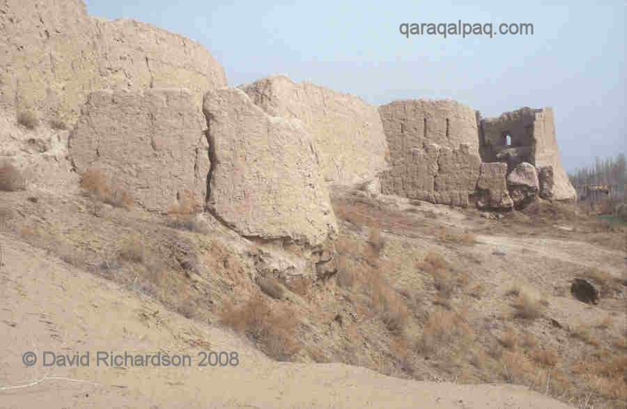
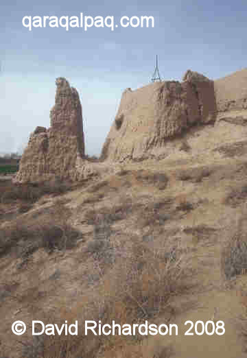
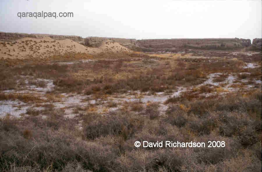
Big Gu'ldu'rsin qala is a rectangular citadel, measuring some 350 by 230 metres. This makes it one of the larger walled cities in Qaraqalpaqstan, some
50% greater in surface area than Big Qırq Qız qala although still only 62% of the size of Axsha-Xan qala. It is in a relatively
good state of preservation - in places the outer walls reach up to a height of some 15 metres.
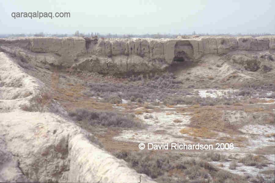
Views of Big Gu'ldu'rsin qala.
It was located on the very eastern edge of the Khorezm oasis facing the Qizil Qum desert and the Qipchaq steppes beyond.
The qala that we see today was mainly built in the 12th century and is what remained after the city was overwhelmed by the Mongols in 1221.
Fortunately the city was not completely obliterated and since the right bank of Khorezm became part of the ulus of Chaghatay rather than
Jöchi, it was never subsequently redeveloped. As such it provides a fine example of an urban centre dating from the time of the Anushteginid
dynasty of Khorezmshahs.
One fascinating feature of the structure is that only the north-east facing wall has been built with arrow slits, arranged in a chessboard fashion.
Furthermore the arrow slits appear to have been built the wrong way round - they point inwards rather than outwards!
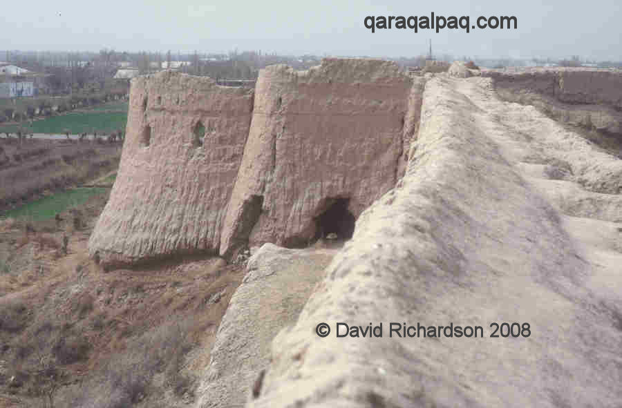
The north-east wall of Big Gu'ldu'rsin qala with arrow embrasures.
The reason is that the 12th century citadel was built next to a much older medieval fort, which had been constructed with double walls on top of a
paqsa socle, the space in between containing the archers' galleries. The older fort was demolished apart from one of its exterior walls,
and this was incorporated into the new citadel. With its inner wall no longer present, the old external wall was reinforced with an outer covering
of paqsa.
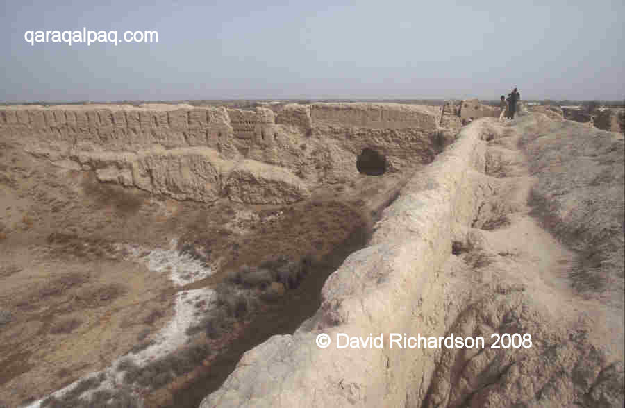
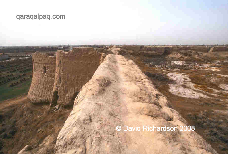
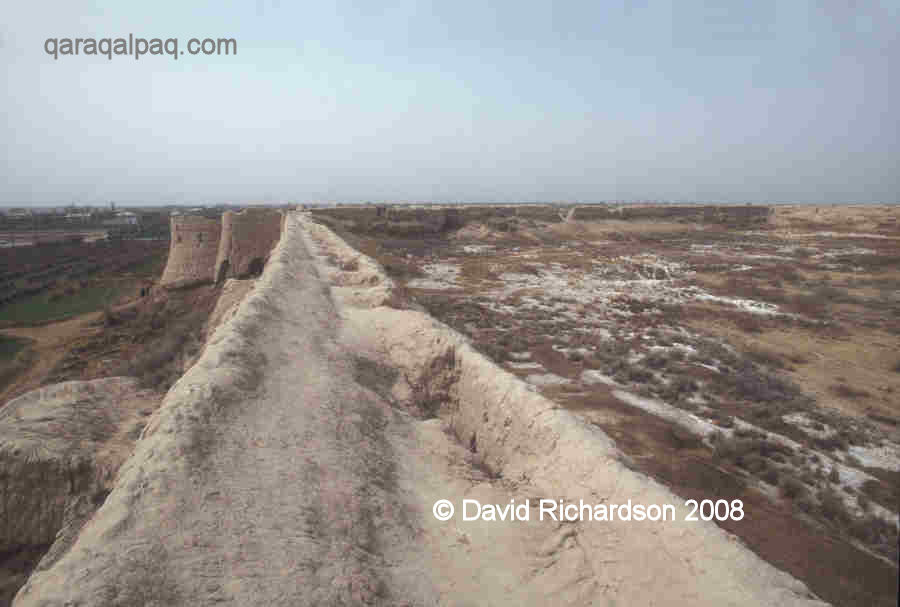
The arrangement of double defensive towers at Big Gu'ldu'rsin qala.
The architecture of the 12th century citadel is quite different from the earlier fortifications of Khorezm. It had a single entrance located in the
centre of the south-east wall, defended by a rectangular barbican, but there were no arrow slits in its outer walls. Instead its flanking walls and
corners were defended by a radically new system of double towers, which projected well out from the line of the walls and provided a wide field of
defensive fire in each direction. It is likely that the outer towers were reached by means of mobile bridges.
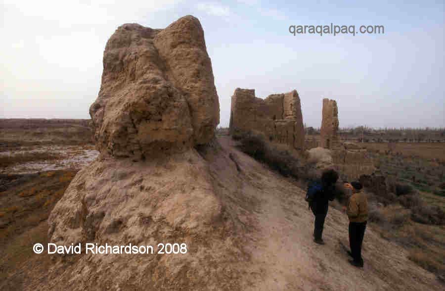
The interior of Big Gu'ldu'rsin qala.
The remains of internal buildings have been found just inside the western and eastern walls and also in the centre of the site.
Small Gu'ldu'rsin qala
Small Gu'ldu'rsin qala is a small medieval palace with a tower and defensive walls. It is situated further westward from Big Gu'ldu'rsin qala, behind the
old river bed.
The Legends of Gu'ldu'rsin qala
The ruins of Gu'ldu'rsin have fired the imagination of the local people who have originated numerous legends about the site. Some have claimed the site
is damned and others say that its treasures were hidden in an underground passage defended by a dragon.
Pathway on the top of the double walls at Big Gu'ldu'rsin qala.
Sergey Tolstov recounted another legend told to one of his young Qaraqalpaq students as a child.
According to the tale, the citadel was once a rich city known as Gulistan, the garden of roses, and it was ruled by an old governor who had a beautiful
daughter named Gu'ldu'rsin. When the city was invaded by warlike Kalmuks, the people's crops and livestock were destroyed and they were soon left
starving from hunger. The old ruler came up with a cunning plan to break the siege of the city. The residents took their best bull and fed him up on
the remains of their grain and then they prominently displayed him just outside the city walls. The Kalmuks, suffering from hunger themselves, realized
that the local people must still have had so much food that they could even continue to fatten their cattle. They realized that their siege was
pointless and prepared to pack up their yurts and leave.
However the governor's daughter Gu'ldu'rsin had other plans. She had fallen for the handsome young Kalmuk prince and to prevent him leaving she secretly
sent her maidservant to see him with a message, telling the Kalmuks to wait for just one more day. When the residents awoke the following morning they
were dismayed to see that their ruse had failed and they had no option but to surrender. The city was burnt and its citizens murdered or enslaved.
The young traitress was brought in front of the Kalmuk prince who told her that for the sake of her emotions she had betrayed her father and her people.
How likely was it that she would remain loyal to him in the face of another strong temptation? He ordered her to be tied to the tails of wild horses. Her body was
torn to pieces and spread over the surrounding fields. Her blood poisoned the soil and turned it into desert. From that day onwards the ruined city
became known as Gu'ldu'rsin.
Google Earth Coordinates
The following reference point (in degrees and digital minutes) will enable you to locate Big Gu'ldu'rsin qala on Google Earth:
| | Google Earth Coordinates |
|---|
| Place | Latitude North | Longitude East |
|---|
| Big Gu'ldu'rsin qala | 41º 41.590 | 60º 58.890 |
| | | |
Note that these are not GPS measurements taken on the ground.
Return to top of page
Home Page
|