|
Location
The two Qırq Qız qalas are designated Big and Little (or in Qaraqalpaq U'lken and Kishkene). They both lie roughly
due east of Ayaz qala in the Ellikqala tuman of Qaraqalpaqstan. Little Qırq Qız qala is 6km to the east of Ayaz qala 1 and
Big Qırq Qız qala is just under 5km further on.
To reach the two fortresses from the Ayaz qala Yurt Camp, return on the rough track that runs south from Ayaz qala 2 until you reach the metalled road.
Continue south for a further 1.4km, crossing the canal and taking the first left. Drive east for 6.3km and turn left at the t-junction. After a
further 2km this new road bends sharply to the right - the ruins of Little Qırq Qız qala can be seen to the north of the road on the left.
To reach the site you have to scramble through several fields of rough vegetation on foot.
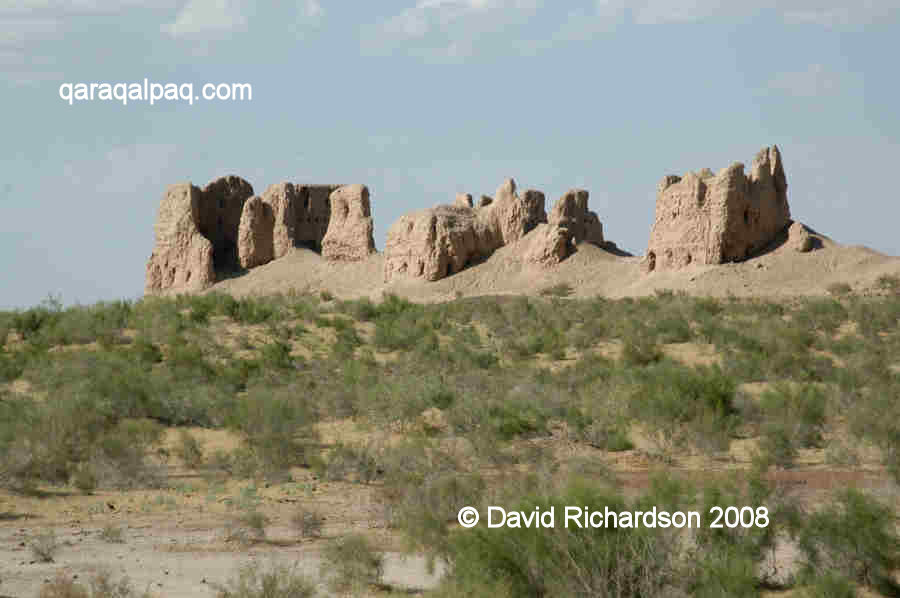
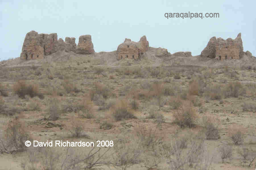
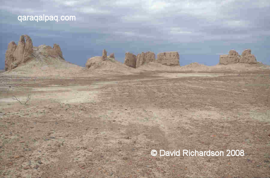
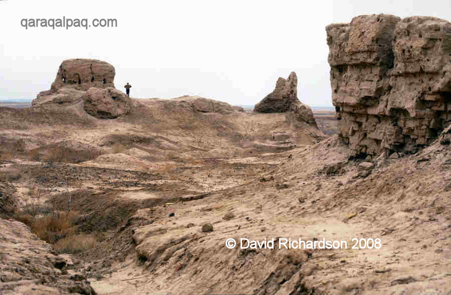
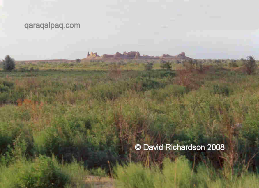
The view of Little Qırq Qız qala from across the fields.
From the same bend the road continues in a straight easterly direction for 4.5km to Big Qırq Qız qala, which is situated directly on the
left side of the road. Access to both sites is unrestricted and of course free.
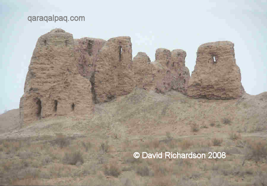
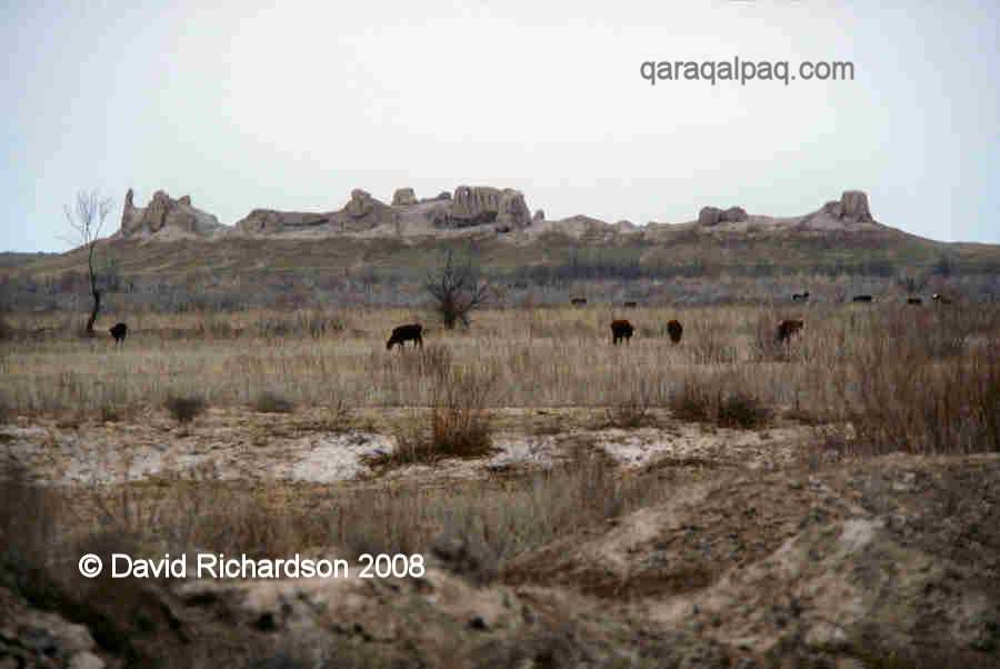
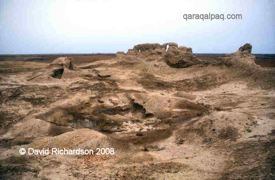
Overview of the northern part of Big Qırq Qız qala from the west.
Rectangular towers on the western wall of Big Qırq Qız qala.
These two fortresses were probably named Qırq Qız by local Qaraqalpaqs at some time during the past two hundred years. The appellation
Qırq Qız refers to the Qaraqalpaq oral epic or da'stan "Forty Girls", which describes how the sixteen-year-old heroine
Gu'layım created her own fortress and then trained forty virgin girls to become a formidable platoon of combatants. When the Qaraqalpaq lands
were finally attacked by the ruthless Kalmuk Khan, Gu'layım and her friends rode to the rescue and freed their Qaraqalpaq brethren from the
heartless oppressors.
In Russian the sites are known as Bol'shoi Kirk Kiz Kala and Maliynki Kirk Kiz Kala.
Excavations
Both sites were investigated by Sergey Tolstov and his colleagues from the Khorezm Archaeological Expedition in 1938. Both sites were examined again
by Xojaniyazov in the late 1970s and early 1980s. Little Qırq Qız qala was excavated by Gertman in 1987.
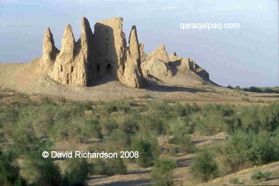
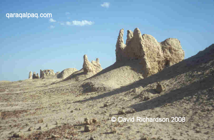
Big Qırq Qız qala
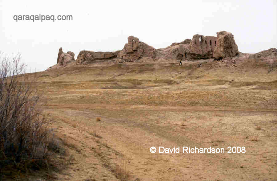
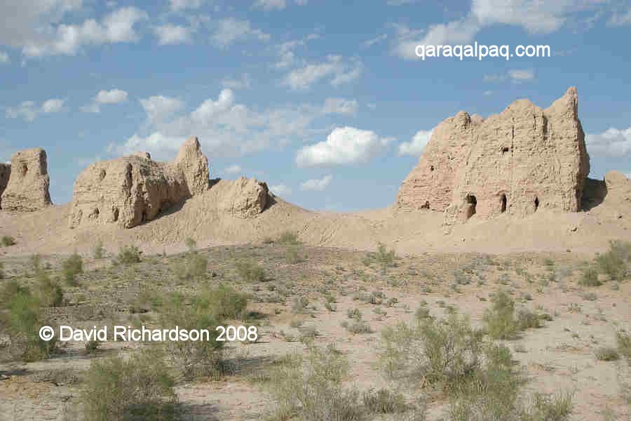
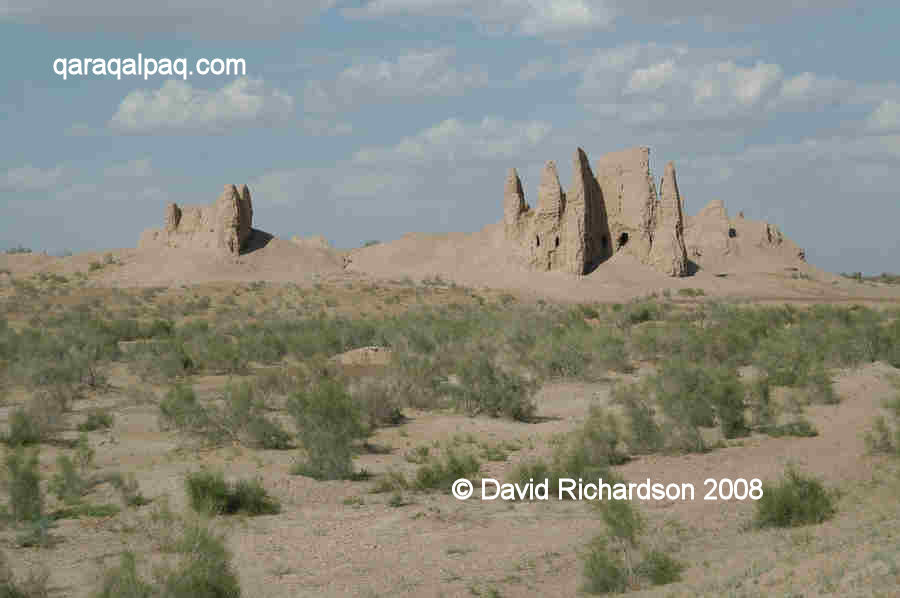
Big Qırq Qız qala is a dramatic looking ruin, especially when viewed in the early morning or late evening light. It almost appears as
though the qala is dissolving into the desert in front of your eyes. Some of remaining sections of walls and towers look like the rock
formations of Cappadocia.
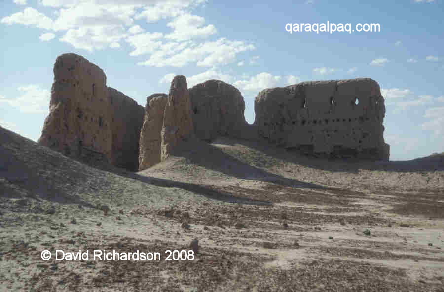
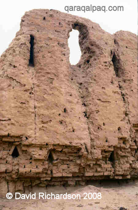
The eroded rectangular towers on the southern corner of Big Qırq Qız qala.
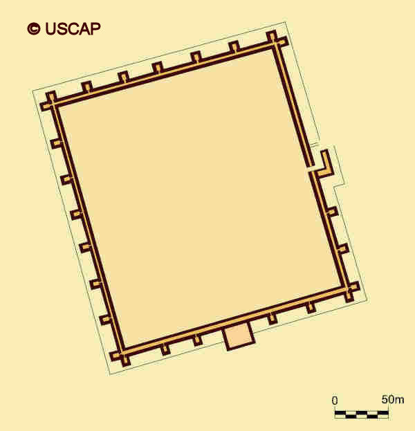
Big Qırq Qız qala is a large rectangular citadel, some 250 metres long by 215 metres wide, covering twice the area of Ayaz qala 1. The
corners are roughly but not exactly oriented towards the four cardinal directions.
Schematic plan of Big Qırq Qız qala.
Image courtesy of Associate Professor Alison Betts, University of Sydney Central Asian Programme.
The citadel was enclosed by double walls, the space between them accommodating two archers' galleries, one above the other, the higher gallery supported
by round wooden beams. The outer wall had two tiers of arrow-shaped loopholes, providing a wide field of fire. However the upper and lower loopholes
were not vertically aligned, creating a somewhat chequerboard appearance.
Three rectangular corner towers at the north-western corner of Big Qırq Qız qala.
Interior of the external curtain wall in the north-west corner of Big Qırq Qız qala.
Note the round holes for the wooden beams that supported the second-storey archers' gallery.
The walls were constructed on a high and rugged plinth, technically known as a socle, made of paqsa blocks and contained a protective
layer of reeds to control salinization. Today the remains of these walls are preserved in a few places up to 10 to 12 metres tall.
North-westernmost corner tower of Big Qırq Qız qala.
Detail of a rectangular corner tower showing some of the interior.
North-westernmost corner of Big Qırq Qız qala.
The outer walls were reinforced with rows of impressive rectangular towers, which might have been up to three storeys high. There were two such towers
on each corner arranged in a so-called dove-tail layout. The entrance was in the middle of the north-east wall and was protected by a rectangular
labyrinth.
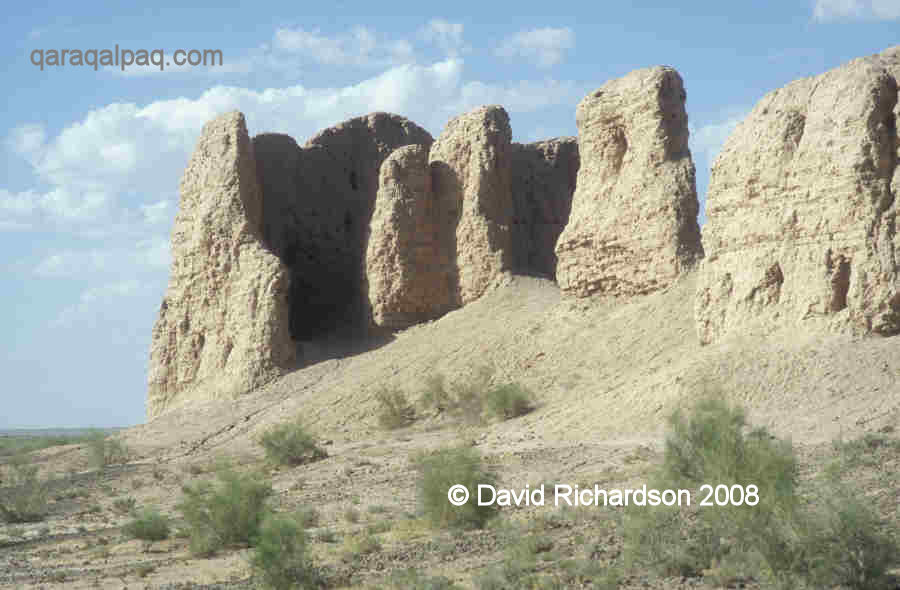
Three rectangular towers at the north-west corner of Big Qırq Qız qala.
Two rectangular towers at the south-western corner of Big Qırq Qız qala.
Note the "dove-tail" layout.
The whole citadel had gained extra protection by the construction of a low outer defensive wall known as a proteichisma, placed about 10 metres
out from the face of the external wall.
The original citadel was constructed in the 4th to the 3rd centuries BC and formed part of the line of defensive forts protecting the northern frontier
of Khorezm. It was a citadel not a refuge, with its interior containing a small town. It guarded one of the main canals feeding the local agricultural
oasis.
Inside of the west flank of Big Qırq Qız qala.
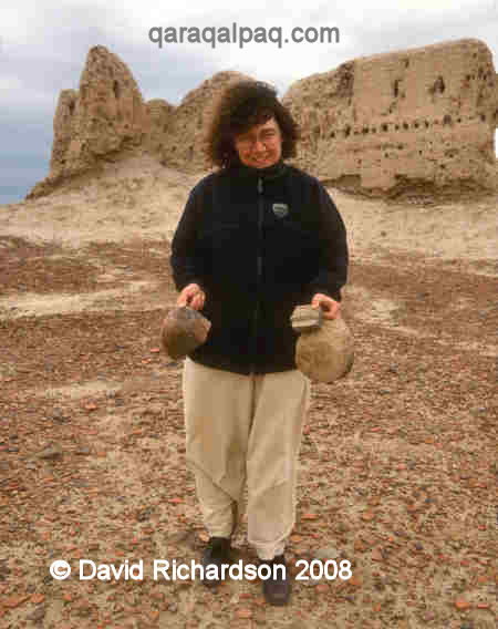
Sue with ceramic finds inside Big Qırq Qız qala.
Interior of Big Qırq Qız qala, looking towards the north-western corner.
The citadel was also active during the Kushan period, between the 1st to the 4th centuries AD, and later during the Afrigid period of the 7th to 8th
centuries AD. It must have been the seat of a local lord during this latter period, since a living tower was constructed just outside the old citadel
located next to the central part of the eastern curtain wall. At some time later another fortified house was built nearby. The region became a major
ceramics and metal producing area during the Afrigid period and the remains of pottery kilns and the slag left over from metal foundries can still be
seen outside the city walls, especially along the western side. The whole interior of the qala is filled with shards of pottery from different
historical periods.
It seems that the region became uninhabited after the 8th century, possibly because of the loss of water for irrigation or perhaps because of the impact
of secondary salinization, which occurs when continued agricultural use eventually raises the water table and makes the soil too saline for any further plant growth.
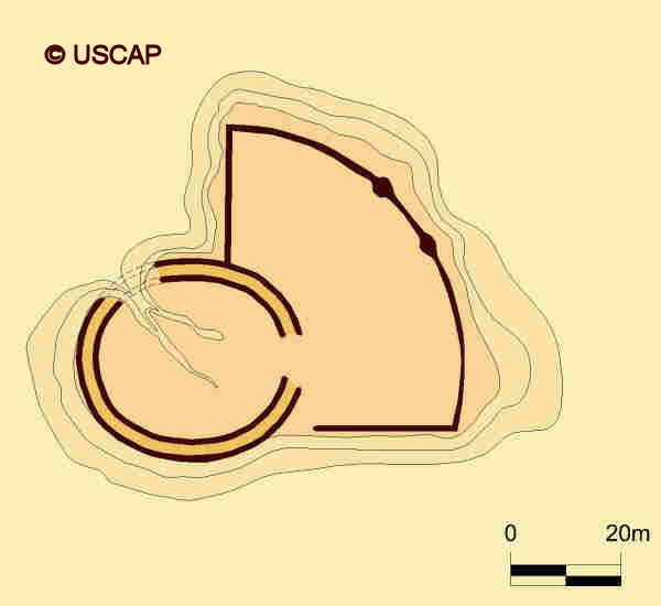
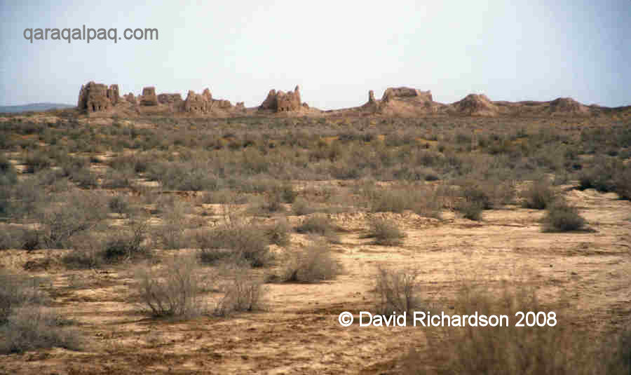
Little Qırq Qız qala
Little Qırq Qız qala is obviously much smaller than its neighbour � just 140 metres from east to west and about 130 metres from north to
south. It is built on a slight natural elevation and is composed of two different parts: a slightly oval-shaped western half and a fan-shaped eastern
half.
Little Qırq Qız qala from the south.
The oval fort on the left and the fan-shaped fort on the right.
Schematic plan of Little Qırq Qız qala.
Image courtesy of Associate Professor Alison Betts, University of Sydney Central Asian Programme.
The western part is some 70 to 80 metres in diameter and is encircled by double walls, separated by a two metre wide corridor containing upper and
lower archers' galleries. These extended around the entire curtain wall since the outside is punctuated by two tiers of arrow-shaped loopholes.
The western oval fort at Little Qırq Qız qala.
Detail of the oval curtain wall at Little Qırq Qız qala.
Showing the upper and lower tiers of arrow-shaped loopholes.
All that remains of the eastern part is the base of a thick wall made from blocks of compacted clay or paqsa. There was a tower on the south
east corner the wall and an adjacent exit with a long external downward sloping ramp.
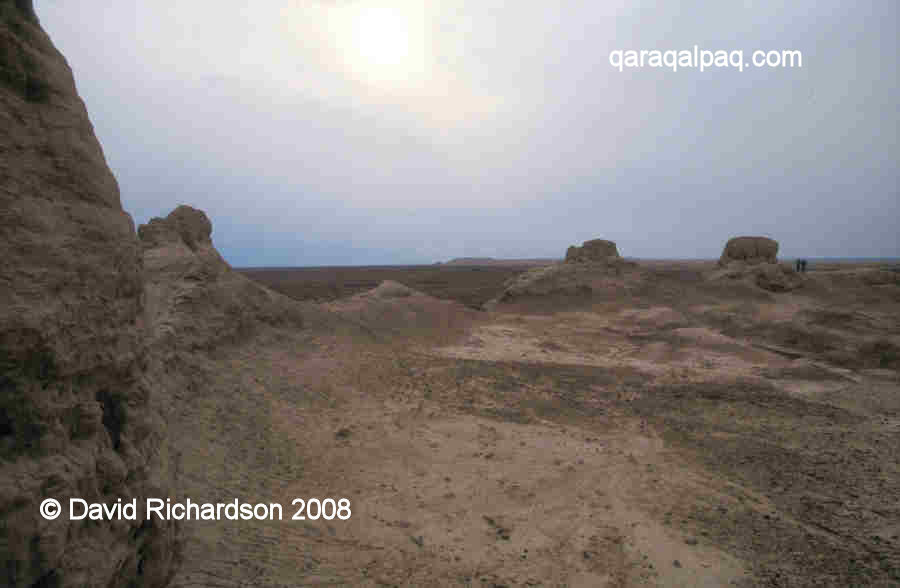
Three different aspects of the interior of the oval fort at Little Qırq Qız Qala.
The second image shows Ayaz qala on the horizon.
The two halves of the site appear to have been linked by an interconnecting gateway, positioned about 10 metres inside the western oval section.
It seems that the fan-shaped eastern half was the original fort, constructed in the 4th to 3rd centuries BC. It was just one of a line of defensive
frontier fortresses guarding the northern flank of Khorezm from external attack. At some time around the 1st century AD the fort was restored and
strengthened and the oval western section was added. The fort seems to have been abandoned at the end of the 3rd or the beginning of the 4th century AD.
Google Earth Coordinates
The following reference points (in degrees and digital minutes) will enable you to locate the Qırq Qız qalas on Google Earth.
| | Google Earth Coordinates |
|---|
| Place | Latitude North | Longitude East |
|---|
| Big Qırq Qız qala | 42º 0.450 | 61º 9.470 |
| Little Qırq Qız qala | 42º 1.090 | 61º 6.075 |
| | | |
Note that these are not GPS measurements taken on the ground.
Return to top of page
Home Page
|