|
Qızıl qala (or Kyzyl Kala in Russian) is located about 25km due north of the centre of Biruniy City. To get there from Khiva drive
through Urgench and cross the Amu Darya pontoon bridge linking Khorezm viloyati with Qaraqalpaqstan. From the north bank check-point drive
north for 2km and then cross the To'rtku'l road. Continue north for a further 1.6km and turn left onto the main highway for just 0.3km before
turning right and continuing for a further 0.2km to the crossroad.
Turn left. From this point the road immediately bends to the right taking you in a northerly direction. After 1.4km you cross the main road and
after 10.8km you take a left turn. From this point the road, which has houses on both sides, continues west for 2.9km before bending to the north.
From now on measure your distances from this bend. Some 3.4km beyond the bend the landscape on the left of the road turns into desert. At 5.8km
from the bend there is a right fork which leads to the entrance to the site of Kazakl'i-yatkan. Ignore this fork and continue driving north.
Some 16.2km from the bend the road bends sharply to the right. You will soon see Qızıl qala set back from the road on the left hand
side. After 17.9km the road crosses a canal. There is a track to the left which runs along the west side of the canal up to the fort.
|
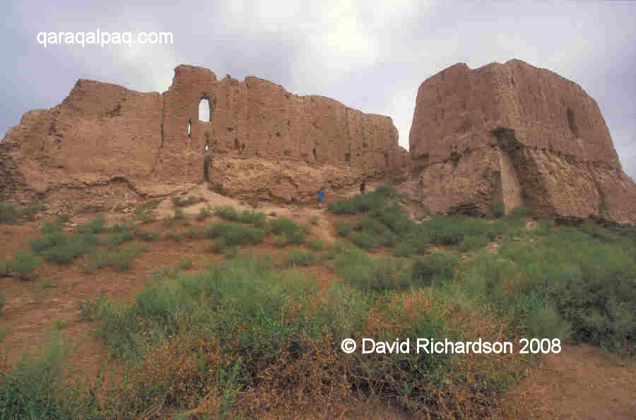
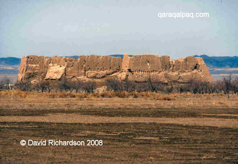
Qızıl qala seen from the south with the Sultan Uvays Dag in the background.
Some archaeologists have proposed that Qızıl qala was a military barracks garrisoned with troops, possibly linked with the nearby
summer palace of Topraq qala just 3km to its east. However this seems questionable given its small size and its lavish interior decoration. It was
more likely the fortified residence of an important Khorezmian aristocrat or official.
Qızıl qala remained largely unexplored until it was excavated by Dr G'ayratdiyin Xojaniyazov and other members of the Qaraqalpaq Branch of the Uzbek Academy of Sciences
in the 1980s.
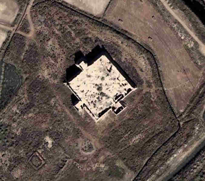
Satellite image of Qızıl qala. Image courtesy of Google Earth.
Schematic plan of Qızıl qala.
Image courtesy of Associate Professor Alison Betts, University of Sydney Central Asian Programme.
The fortress is situated on the flat plain just south of the Sultan Uvays Dag mountains and seems to have been constructed on a slightly raised platform.
It is still in relatively good condition on the outside and is almost square, measuring just 65 by 63 metres, with its corners orientated towards the
cardinal points. The curtain walls are up to 16 metres high and on three of the four sides consist of parallel external and internal walls separated by
a two-metre wide corridor. The external wall contains two rows of regularly spaced arrow-shaped loopholes that were presumably accessed from separate
galleries.
The entrance ramp and barbican of Qızıl qala.
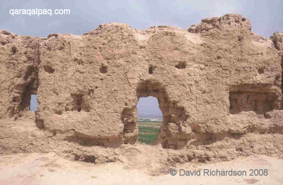
There is just one entrance, located in the middle of the south-east wall. This was accessed by means of a protruding rectangular barbican with a gate
in its south-western side. The entry ramp to this gate slopes upwards alongside the main curtain wall of the fort, where it could have been covered by
defending archers.
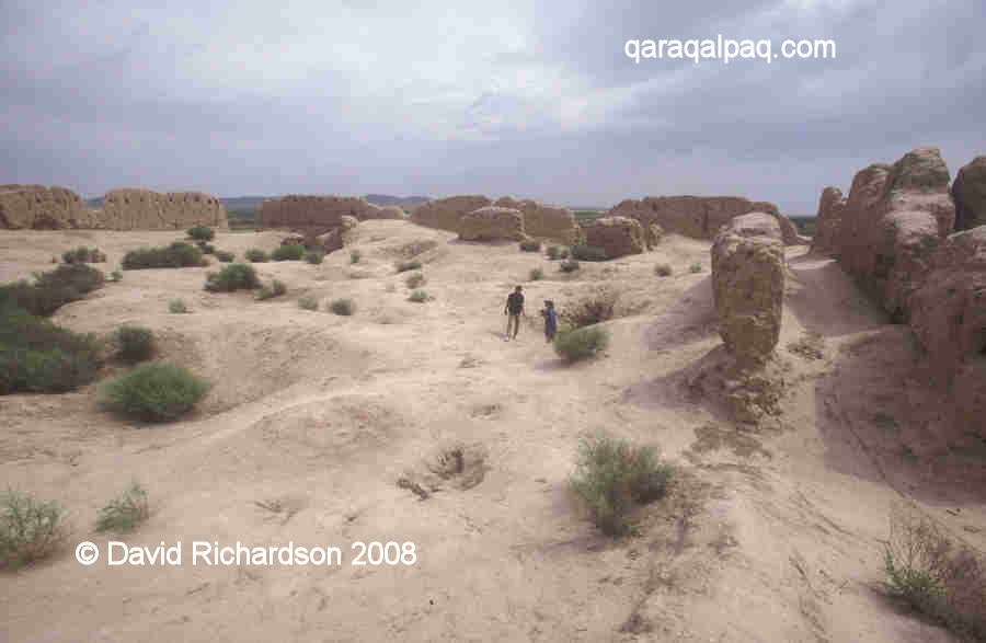
The interior wall of Qızıl qala.
Panorama of the interior of Qızıl qala showing some of the double walls.
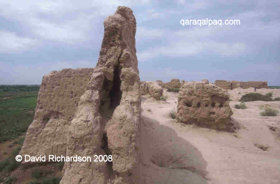
A profile of one of the outer walls of Qızıl qala.
In addition there are two large protruding rectangular towers positioned in the middle of the north-west and south-west walls. These contained pairs
of rectangular rooms. Rooms were also discovered within the interior of the fortress. In addition to the normal ceramics, glass, stoneware and
fragments of bronze, the excavations also uncovered remains of wall frescoes, suggesting that it was occupied by a high-status individual and his retinue.
The fort was built in the 1st or 2nd centuries AD and is therefore contemporary with Topraq qala. It was occupied until the 4th century and then
abandoned. It seems to have been restored much later, during the 12th or early 13th century, just prior to the Mongol invasion.
Google Earth Coordinates
The following reference point (in degrees and digital minutes) will enable you to locate Qızıl qala on Google Earth.
| | Google Earth Coordinates |
|---|
| Place | Latitude North | Longitude East |
|---|
| Qızıl qala | 41º 55.807 | 60º 47.050 |
| | | |
Note that these are not GPS measurements taken on the ground.
Return to top of page
Home Page
|