|
Location
Angka qala is located on the eastern side of the tuman of To'rtku'l, just under 24km north-east of To'rtku'l town. It is only about 4km
east of the desert site of Qoy Qırılg'an qala.
Excavation
Angka qala was initially investigated by Sergey Tolstov and his colleagues Yakh'ya Gulyamov and A. I. Terenozhkin from the Khorezm Archaeological
Expedition in 1938, while they were based at nearby Teshik qala.
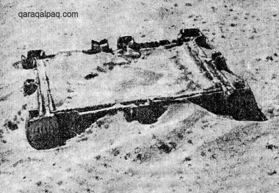
Aerial photograph of Angka qala, showing a relatively well-preserved fort.
Taken by the Khorezm Archaeological Expedition, probably in the late 1940s or early 1950s.
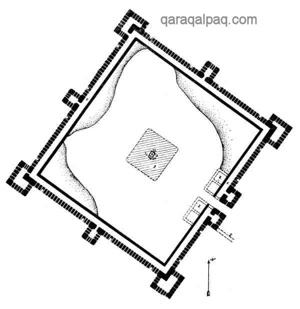
Schematic plan of Angka qala. From Tolstov's "Ancient Khorezm", 1948.
Tolstov described how his party reached Angka qala at sunset after crossing a desert covered with many ridges of newly blown sand. As the sun was
setting, he climbed on the walls and looked into the purple sky to his west:
"There were infinite ridges of sands and countless number of black silhouettes of towers of Berkut-kala, the dead oasis stretching 17 kilometres away
from north to south. It was very silent in the kingdom of the desert and we felt that we were in a city of ghosts built by the titanic strength of
ancient conquerors."
All of those feudal forts have subsequently disappeared having been destroyed by the agricultural development of the 1960s and 1970s.
The architecture of the site was re-examined by G'ayratdiyin Xojaniyazov in the early 1980s.
Angka qala
Angka qala dates from the Late Antique period of Khorezm, around the 1st to the 3rd centuries AD - the time of the Kushan Empire. It seems to have
been established on the eastern edge of Khorezm to guard the main caravan trade route to the east.
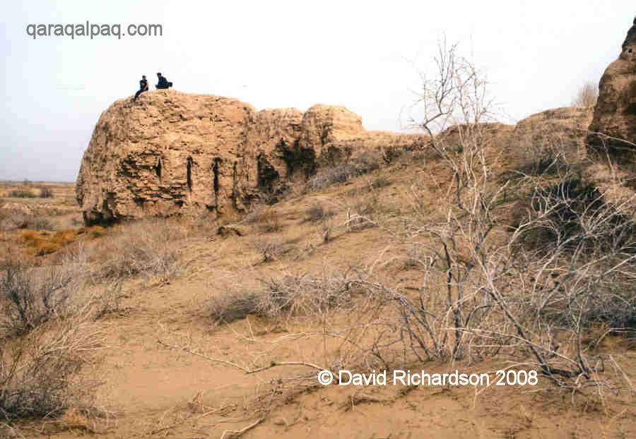
Local youths relaxing on one of the corner towers at Angka qala,.
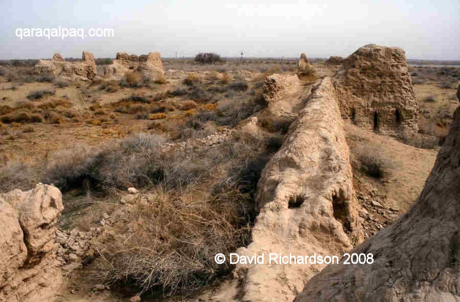
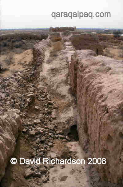
The double curtain wall and a side tower at Angka qala.
The two towers of the entrance gate are in the distance to the left.
The fort is small but well defended. It is almost exactly square-shaped, measuring about 90 metres along each side, and its corners are oriented
towards the four cardinal points. It has double walls set on a paqsa plinth with a 2.5 metre wide corridor in between to accommodate the
archers' gallery. There is a projecting square tower at each corner providing defensive cover for the adjacent curtain walls. These towers seem to
have been originally built several metres above the height of the curtain walls. The entrance to the fort was in the middle of the south-east wall,
defended by two rectangular towers. The curtain walls and towers contain just a single row of arrow-shaped loopholes.
View over the interior of Angka qala.
In the interior there were a pair of rooms on each side of the entrance. Otherwise the interior of the fort was an open courtyard devoid of any
buildings. In its centre was a low square-shaped flat mound containing a well lined with stone, a vital resource in times of attack or siege.
The exterior of the fort was defended with a low proteichisma wall made of paqsa blocks, situated some 10 metres out from the wall
and completely surrounding the site.
The fort seems to have gone into decline between the end of the Afrigid feudal period and the completion of the first millennium. The flow of the
eastern branch of the Gavkhor canal lost about half of its volume, leading to a collapse in the agricultural economy of the region surrounding
Angka qala.
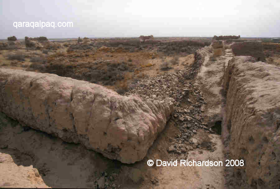
The wide space between the outer and inner wall, showing a recent collapse of a section of inner wall.
The current condition of the fort is not good. The towers are in the best state of preservation, reaching up to 5 or 6 metres high in places, but a
lot of the curtain walls have been heavily eroded. At the time of our last visit in 2004, part of the internal wall had recently collapsed.
Google Earth Coordinates
Unfortunately Angka qala is not properly covered by Google Earth at present. The following reference point (in degrees and digital minutes) will enable
you to roughly locate Angka qala on Google Earth:
| | Google Earth Coordinates |
|---|
| Place | Latitude North | Longitude East |
|---|
| Angka qala |
41º 45.500 | 61º 9.095 |
| | | |
Note that these are not GPS measurements taken on the ground.
Return to top of page
Home Page
|